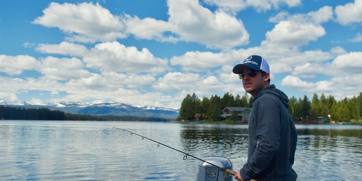
At FishAngler, we love nothing more than to feel the wind on our face while running offshore or across a lake to our favorite fishing spot. Fishing boats can be a key ingredient to an angler’s success. Whether you’re heading offshore on your Boston Whaler rental from Boatsetter or paddling a kayak through the reeds of your local lake, a fishing boat can offer you freedom and opportunity not found on the shore. Here are some of the best FishAngler app features for navigating your favorite bodies of water.
Track Buoys
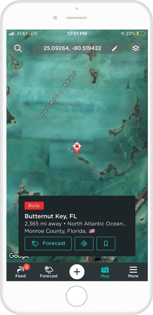
Any angler who has spent time on the open ocean knows the importance of buoys. The safety of you and your boat can be dependent on these buoys. But they also offer a place to attach in the middle of the vast oceans, as in the case of a mooring buoy. Knowing the locations of buoys all across the ocean is just as important as the safety they provide. Lucky for you, FishAngler provides buoy locations set against a base map of aerial imagery.
 How to only show buoy locations:
- Select the icon in the top, right-hand corner of the screen.
- Under Layers, select the map layer waypoints, (like Catches, Fishing Spots, Buoys, etc.) you want to to show on your map.
- If you unselect all layers and just select “Buoys/Stations”, the only waypoint icon that will appear on your map will be the red icons indicating the buoys within the region you’ve honed in on.
Your location on the map will appear as a blue dot. If you need to readjust your location, tap the crosshairs icon. You can select each buoy (red waypoint) for an information card with specific data, including the name, distance from you, station ID, and it’s exact location.
Monitor the Tides
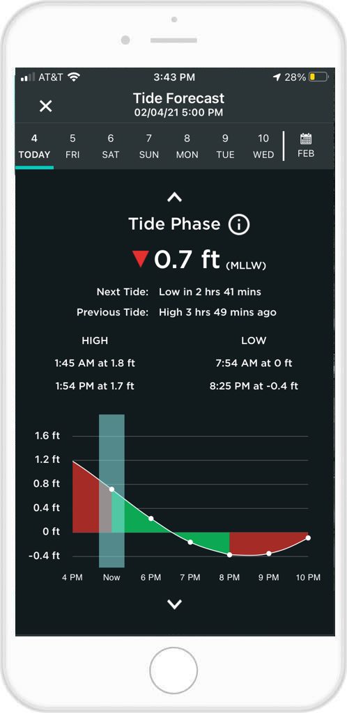
Tide’s are just as important for launching a fishing boat as they are for successful fishing. Targeting species like redfish, sea trout and others require the angler to time the tides properly. This is also important for kayak and skiff anglers as well. The fall and rise of the tides will greatly impact where species are present and where your boat will not get moored on the ocean bottom.
All salt anglers keep a sharp eye on tide charts and now that information can be with you at all times.
Tap the Forecast icon at the bottom of your app screen. This menu provides up to eight different specific forecasts to help plan your trip. The Tidal Forecast will tell you when the highs and lows will occur each day on an easy-to-read graph.
 To get a forecast for your location you can:
- turn on your phone’s location services, utilizing the phone’s internal GPS,
- select your fishing region in your profile by accessing “More”, then “Edit Profile” and scrolling down to Angler Interests,
- select a location by manually typing in the area you are looking to fish,
- or find a buoy, tap the buoy and select the forecast icon on the buoy/station information card.
Monitor Posts
The ocean is vast, no doubt about that. Even anglers searching the coastline need a pointer on where certain species may congregate, or at what times. Anglers on a fishing boat should also be highly observant for submerged hazards. Reefs, sand bars, or sunken structures can pose major threats. Fishing posts can inform you of these!
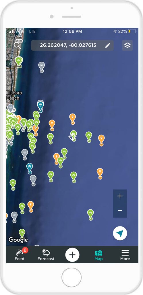 On your FishAngler Map, you can select and monitor different types of posts from different anglers. You can keep track of information provided by other anglers, which includes catches, specific species, or even reports which may warn of hazards.
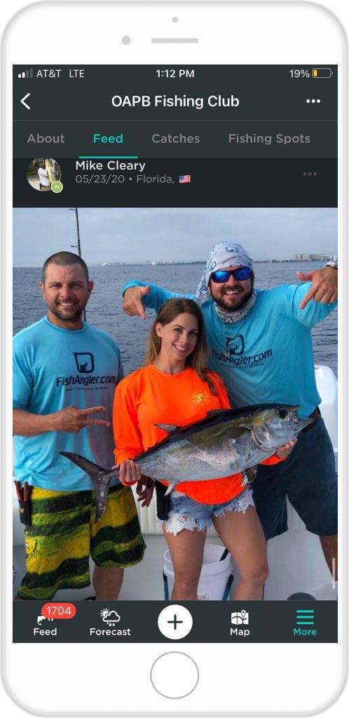
Offshore Groups
FishAngler Groups provide the perfect place to meet other fishing boat captains and anglers. Groups like Offshore Anglers of Pompano Beach. Group members create posts regarding recent catches, fishing information and ocean conditions.
Groups exist all over the country and not just for saltwater anglers, either. Anglers with fishing boats can find FishAngler Groups for bass lakes and trout streams spanning the country. Along with different oceans and seas across the world, of course!
 To find a fishing group just tap the “More” icon in the bottom, right-hand corner of your app screen and scroll down to “Groups” under the Discovery section. You can then scroll the list of groups that populates, or use the search bar at the top of the screen to look for groups in your area or in an area you plan on visiting.
If you don’t find a group specific to the body of water you’re looking to fish, we highly encourage users to start their own! You can start your FishAngler Group by tapping the “+” icon in the top right-hand corner of the Groups screen. Identify your group name, an image, and some details, as well as the location of the group. Next you’ll be prompted to identify some group interests like boating, kayaking, engines, freshwater, saltwater and more! Lastly, you can decide whether your group is Public, closed or secret. Once your group is established, begin inviting users!
NOAA Weather
Nothing can change a day on the water faster than the weather. It doesn’t matter if you’re on the open seas, the Great Lakes, or a local river; bad weather is not to be overlooked.
Like the tides, captains and boaters always pay close attention to weather patterns. And the best free fishing app on the market puts that info neatly in your pocket!
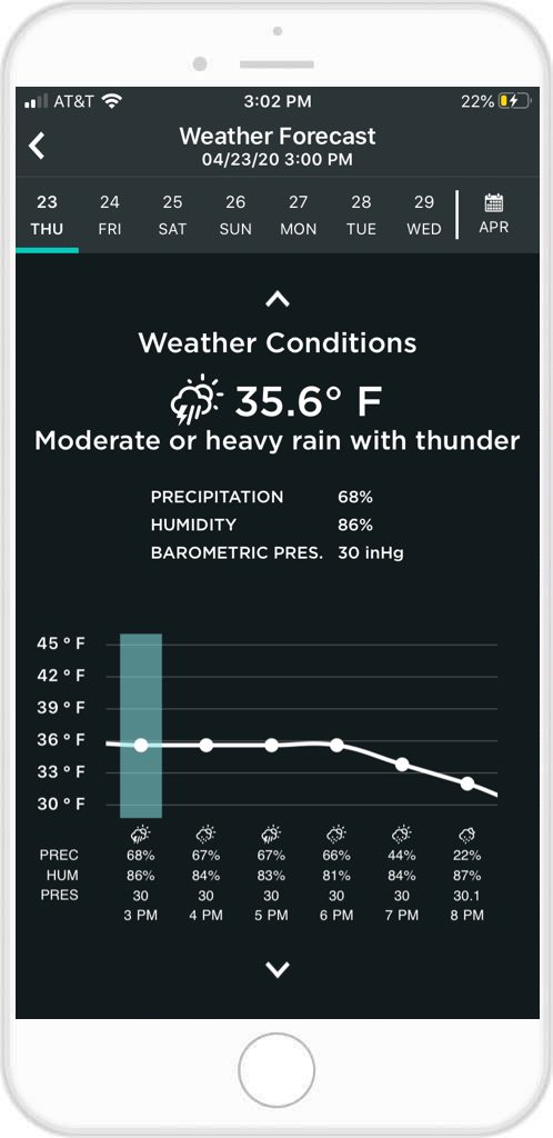 Like the Tidal Forecast, the weather for your area can be accessed via the Forecast icon at the bottom of your screen. The FishAngler app uses NOAA 7-day forecasting information to give you a week’s worth of data in an easy-to-read chart. Knowing the weather for the entire day is a powerful safety tool that should not be taken for granted.
When the weather is right and the bite is on, there is nothing quite like the freedom a fishing boat offers. The lapping of waves on your hull, and the feeling of the open air on your face as you set course toward the unknown is one of the best feelings an angler can have.
Thanks for reading, and be sure to check out the Boatsetter Contest going on NOW on the app for a chance to win some sweet boating gear!
Download the FishAngler app for FREE!