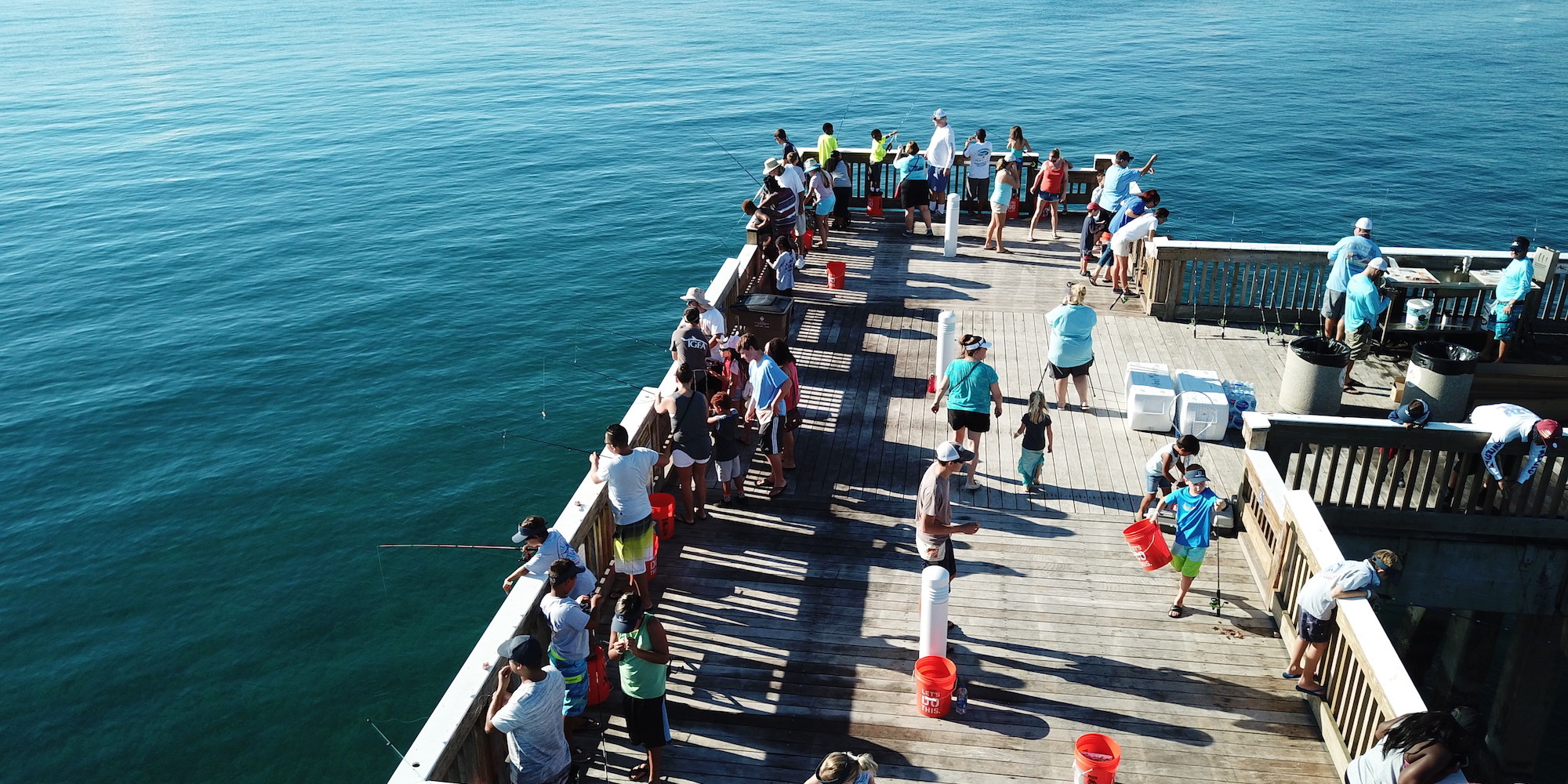
Offshore and inshore anglers alike know the necessity of planning their fishing trips around tide heights and times.
Tide data is imperative for targeting specific species, as well as monitoring underwater hazards when launching your boat.
Most coastal anglers read and treat their tide charts like a holy book, but with FishAngler’s Forecast feature, all your tidal data sits waiting in the palm of your hand.
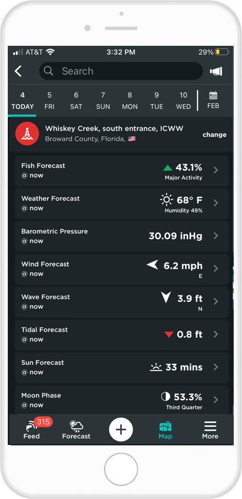
Along with weather, wind, Solunar data, barometric pressure and other functions, your coastal tide data is provided by up-to-date NOAA marine buoy & USGS inland station monitoring. The information appears whenever you tap the Forecast icon at the bottom of your FishAngler app screen. No other fishing app gives as detailed tide data in one easy-to-read tide chart!
 First Things First
1. To get the proper tide data for your area, make sure the location services are allowed for your FishAngler app.
2. If you don’t want to turn on your location services, you can change your location manually in your settings. Select the “More” button on the bottom, right-hand corner of your FishAngler app screen. Select “Edit Profile” and scroll down to “My Fishing Region” under Angler Interests. Confirm your location from a 10 to 500 mile radius of your present location.
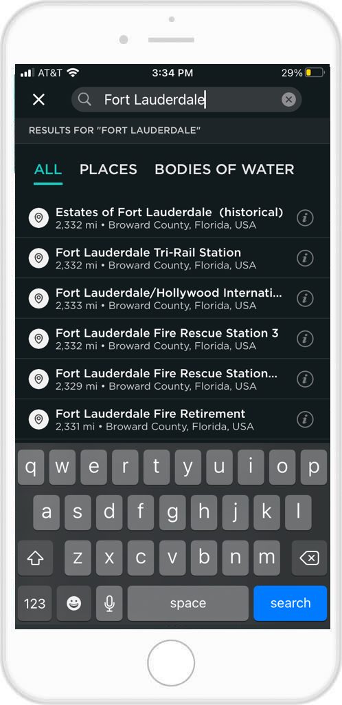
3. You can also select the Forecast icon at the bottom of the app screen and change your Current Location by selecting the “Change” button to the right of it. Either conduct a search at the top of the screen or select a Recent or Nearby location.
 Find a Buoy Near You
1. You can also find the proper tide information by locating buoys in the area you’re planning to fish.
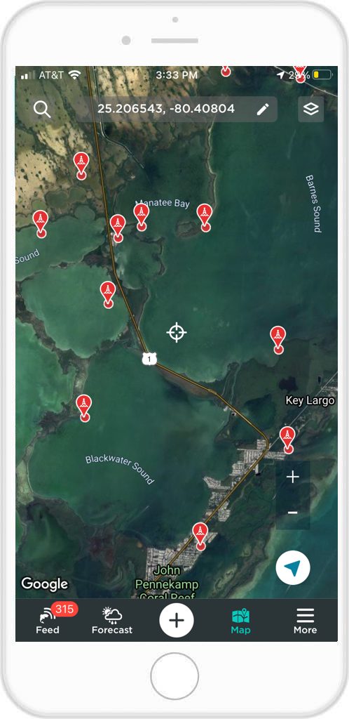
2. To find a buoy, go to the FishAngler Map and find the area you’re planning to fish.
 3. Select the icon in the top right-hand corner. Scroll down a little under the Layers section and ensure that your Buoys/Stations layer is checked.
4. Go back to your map and find a red waypoint icon indicating a buoy and select it.
5. The information card will pop up at the bottom of your screen and will show you the name of the buoy location, the county it is located in, it’s distance from you and it’s Station ID number.
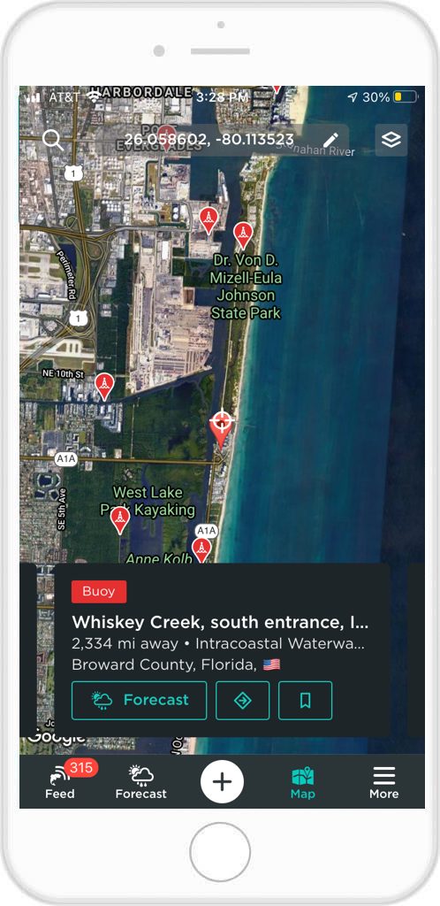 6. You can select the Forecast icon at the bottom right-hand corner of the information card (signified by a sun and stormcloud) to bring up the complete forecast of that area, including the tide conditions for the week.
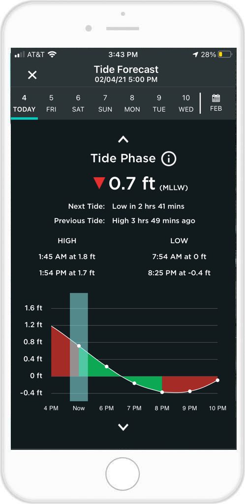
Your Tide Chart
When open, your Tide Forecast will give you exact highs and lows of the day’s tides, as well as corresponding times for each high and low. You will also get the predicted time until the next high tide, as well as how long ago the previous tide was.
The chart will also provide you with a graph outlining rising and falling tides throughout times of the day. You can even scroll through the week and plan later fishing trips by getting the highs and lows for the next six days.
 At FishAngler we know the importance of accurate tide data. We hope every angler uses the FishAngler Forecast feature to make their trips easier and more successful.
Download the FishAngler app for FREE!