Fishing spots are often guarded like precious treasure, and for good reason. Keeping secret spots a secret is an age-old practice, but this lack of sharing information can make it hard to find new places to fish.
Don’t have the FishAngler app? Download it for FREE now:


FishAngler’s fishing maps, luckily, take a lot of the guesswork out of finding your new favorite fishing spot. FishAngler’s intuitive fishing maps combine the best of satellite imagery and fishing waypoints to help users further explore familiar bodies of water and new ones.
Read on below for more information regarding the best free fishing maps available and how to use them to find your next favorite fishing spot.
Map Styles*
 Standard
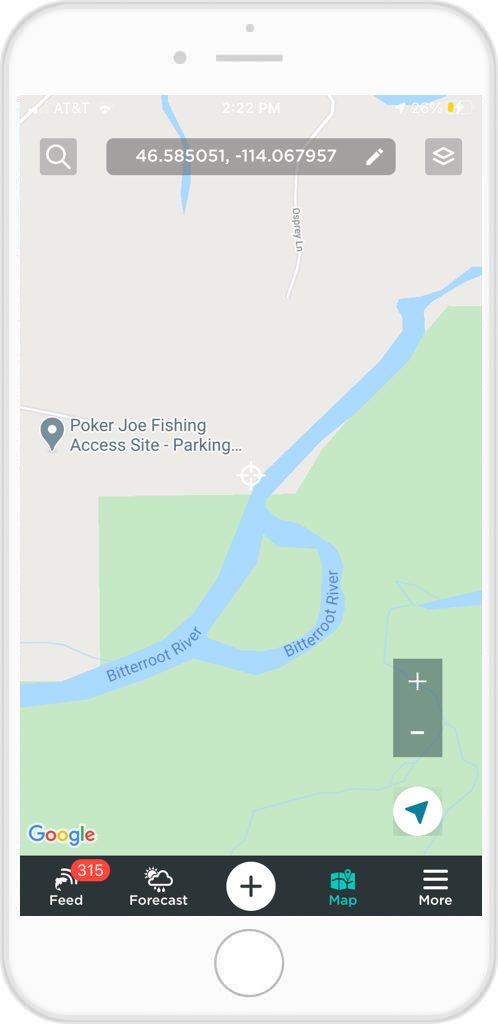
FishAngler fishing maps offer three different base maps to help you navigate. FishAngler maps utilize Google maps for a standard map view featuring roads, highways, city streets and labeled cities. This is your navigational map for trying to find the best routes to boat launches, public fishing access sites, and other new stretches of water. Your position will be represented as a blue dot on each map and you can always find your position by tapping the crosshair icon in the bottom right corner.
 Satellite Imagery
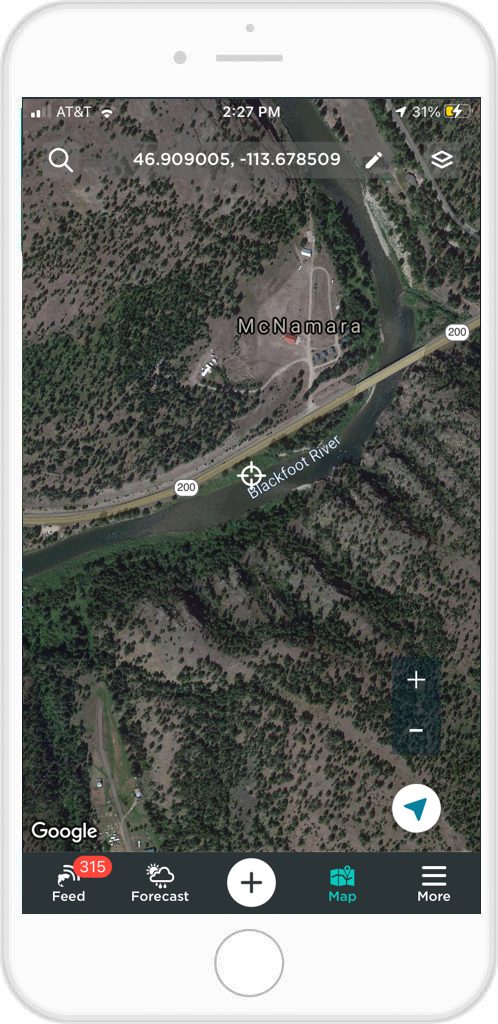
You can also choose from a satellite imagery base map, which will give you a detailed map depicting exact satellite photos from any area. This option is best used for actually getting the lay of the land and scouting new water. With satellite imagery you can zoom in on a single point, looking for bends in rivers, overhanging cover in ponds and lakes and more, thus zeroing in on a new fishing spot.
 Hybrid
The third base map option is a combination of the two, which gives you satellite imagery with major roadways and cities labeled. This option is the best of both worlds, allowing for navigation and inspection of varying fishing terrain.
*To change between each layer, simply tap the top right button on your map screen. Next select the “Layers” tab at the top of your screen and choose between, Hybrid, Standard, or Satellite view.
Map Layers
To go along with your base map, FishAngler offers seven map layers for further information laid out across your map view. You can add as many or as few map layers as you want at any time.
Bodies of Water
Adding the bodies of water layer puts labels on all bodies of water in your area. This is helpful for finding new lakes and ponds you have only heard of, or new water altogether. On the map the bodies of water will appear as blue waypoints. Tap on the waypoint for even further information like the name, elevation, and size of the body of water, and even if the water is privately or publicly accessible.
 Catches
This layer will appear as a green waypoint and display catches from other FishAngler users, displayed on the body of water the fish was caught. Tap the waypoint for a photo of the catch and then tap the catch icon for more details regarding the catch.
Fishing Spots
This layer will only show you fishing spots that members posts. The icons will appear yellow and when clicked on will display a photo of the fishing spot and information regarding the body of water, water depth, bottom structure and more.
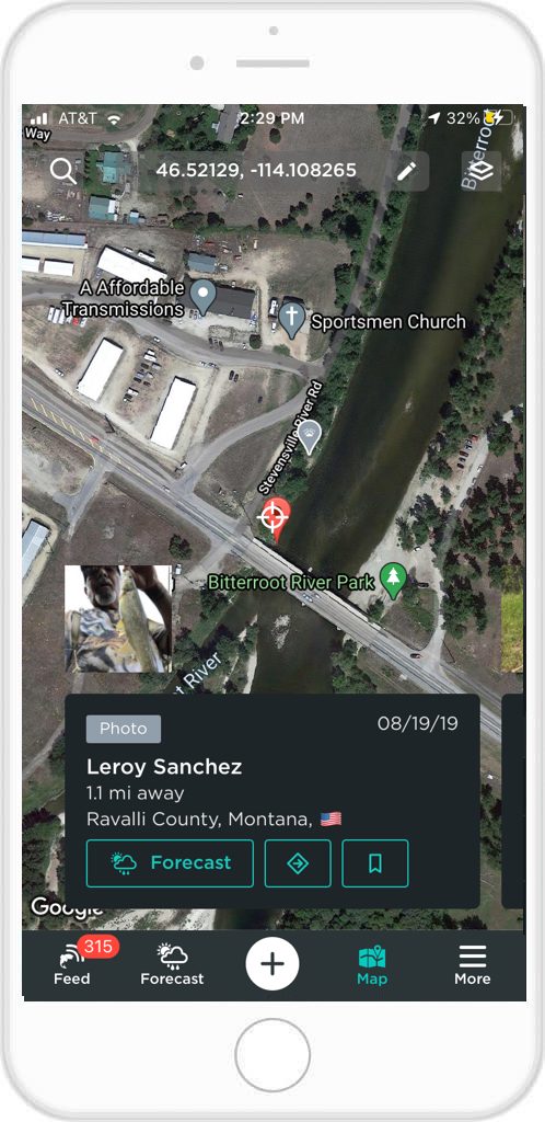 Photos
The photo waypoints will appear grey and when tapped on will display user photos from the area. These posts will contain little information other than the photos provided, but give a great idea of what the water looks like and varied fish sizes.
 Reports
Reports appear blue and are the detailed fishing information you need to learn a new area. When tapped on, reports contain photos and detailed information regarding a catch. Reports can contain information regarding species caught, techniques used, bait type and even weather conditions that led to the catch.
Buoys
When selected, Buoys will appear as red waypoints across your map.
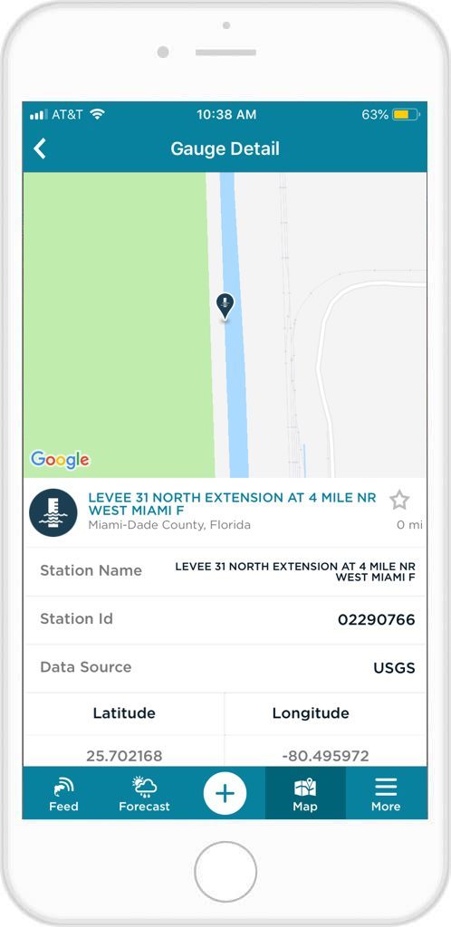
Gauges
Gauges appear dark blue and will provide the name of a body of water, along with key flood stage data.
My Posts only
You can also clear out all other users catch information, leaving your posts, photos and reports for you to browse and learn from. This can be especially helpful when revisiting fantastic days on the water. All the information you store will be easily available and displayed exactly where you caught it.
The world is vast and full of new and exciting fishing opportunities. FishAngler is your tool for exploring new water and finding that new perfect fishing spot! Use FishAngler’s fishing maps and be sure to show off your success in new and unfamiliar bodies of water on the app.
Download the FishAngler app for FREE!