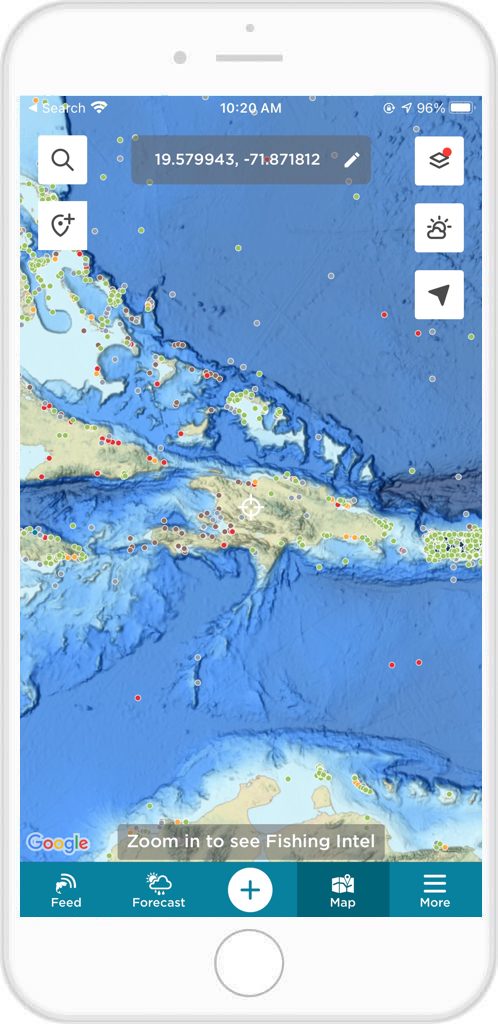
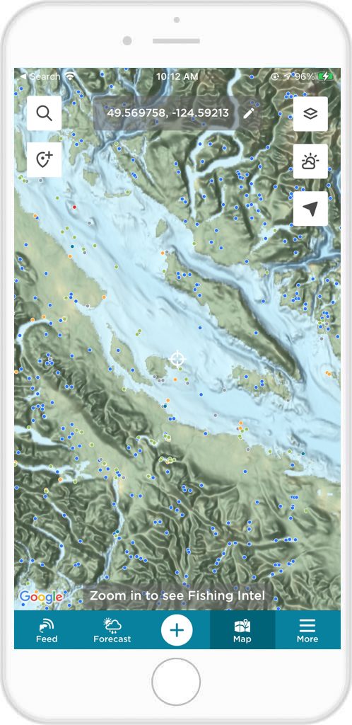
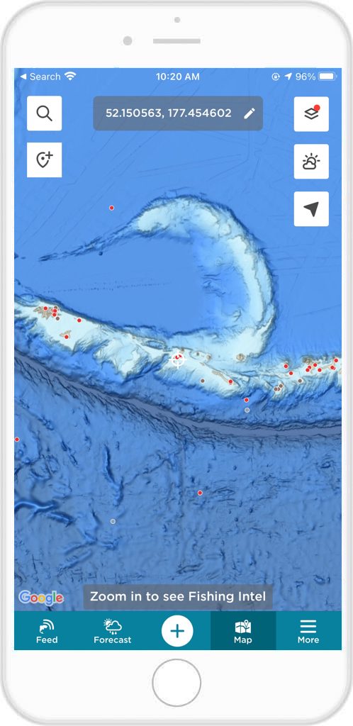
In the world of angling and fishing, technology continues to revolutionize the way enthusiasts pursue their favorite pastime. From advanced fishing gear to sophisticated fish finders, technology has significantly enhanced the fishing experience. One such technological advancement is the integration of map types tailored for specific purposes within fishing apps. The FishAngler app is taking this concept to the next level by introducing the General Bathymetric Chart of the Oceans (GEBCO) map type.
This integration promises to redefine the way anglers explore water bodies. Anglers get a comprehensive understanding of underwater landscapes like never before. The GEBCO map is a global initiative that compiles bathymetric data from various sources. The map layer supplies detailed images of ocean depths and underwater terrains. These maps are primarily used by marine researchers and navigators. However, their integration into the FishAngler app opens up a new world of possibilities for anglers.
Don’t have the FishAngler app? Download it for FREE now:


Enhanced Fishing Strategies
Traditional fishing maps often focus on surface features such as contours, structures, and potential fishing hotspots. The introduction of the GEBCO map type takes this a step further by providing anglers with a glimpse of what lies beneath the water’s surface. Users can now access data on underwater ridges, canyons, trenches, and other bathymetric features that influence fish behavior and movement patterns. Understanding the underwater landscape is crucial for devising effective fishing strategies. The GEBCO map type enables anglers to pinpoint areas where fish are likely to congregate based on the underwater terrain. For example, underwater drop-offs might attract predatory fish looking for ambush points, while underwater structures could serve as hiding spots for certain species. By incorporating this newfound knowledge, anglers can refine their approaches and increase their chances of success.
Planning Fishing Expeditions
Whether you’re planning a fishing trip to a new location or revisiting a familiar one, the GEBCO map type can be an invaluable planning tool. It allows anglers to identify potential fishing zones based on the underwater landscape. Thusly, anglers can tailor their trips to target specific species or fishing conditions. This level of precision empowers anglers to make the most out of their outings. Fishers can potentially discover hidden gems that were previously overlooked.
The integration of the GEBCO map type also presents an educational opportunity. Anglers can deepen their understanding of aquatic ecosystems. They can experience firsthand how underwater geography influences fish behavior. By learning about underwater features and their effects on local fish populations, anglers can become more informed and responsible stewards of the environment.
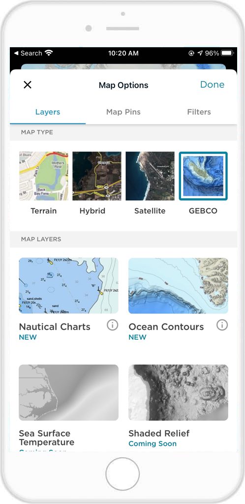
To Access the GEBCO Map Type on the App:
- Open the FishAngler app on your device
- Tap the “Map” icon at the bottom of your app screen
- Select the layer icon at the top right-hand corner of your map screen
- On the Map Options screen, tap the GEBCO map type at the top of the screen
- Tap “Done” at the top right-hand corner of the screen
- Navigate to the area of the map you’d like to explore with this view
In summary, as technology continues to intersect with the world of fishing, the FishAngler app’s introduction of the GEBCO map type marks a significant milestone. This innovation elevates the angling experience by equipping users with a comprehensive view of underwater terrains and their impact on fish habitats. With enhanced fishing strategies, improved trip planning, and a wealth of educational insights, anglers using the FishAngler app can take their pursuit to new depths. Both literally and figuratively!
So, whether you’re a seasoned angler or just starting out, the GEBCO map type promises to be an indispensable tool in your fishing arsenal.
Don’t have the FishAngler app? Download it for FREE now: