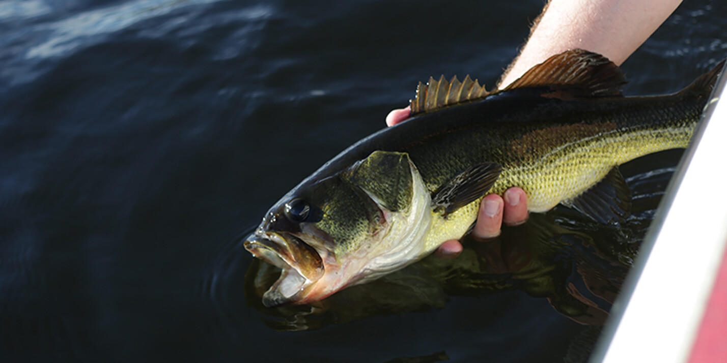
The key to a successful day on the water lies in understanding the underwater terrain, the movements of aquatic life, and the hidden hotspots where fish are most likely to bite. That’s why we’re thrilled to introduce you to game-changing fishing map layers – exclusive to FishAngler VIP subscribers.
In this blog, we’ll explore what makes fishing map layers a must-have for any angler looking to improve their fishing success, revealing the hidden treasures beneath the surface and the secrets of the fish’s habits.
Don’t have the FishAngler app? Download it for FREE now:


Navionics™ HD Depth Charts
Offering unparalleled accuracy for navigating and exploring underwater landscapes, Garmin Navionics Depth Charts provide 1’ HD bottom contour detail. Enhanced by boater-contributed sonar logs, these charts are frequently updated to ensure reliable information. Whether discovering new waters or returning to familiar spots, Navionics Depth Charts help anglers identify fishing hotspots, navigate intricate waterways, and uncover hidden structures. This layer is invaluable for those who demand precision and reliability from their mapping tools, allowing users to unlock the secrets beneath the surface.

U.S. Nautical Charts Map Layer
For anglers, nautical chart maps are like treasure maps on the open water. These meticulously crafted charts are our trusty companions, born from extensive surveys of the deep blue. They reveal the secrets of the sea – the water depths, hidden structures, tides, and currents. But why are they essential for us? Well, imagine this: you’re out on your boat, chasing the catch of a lifetime. Nautical charts are your guardian angels, helping you steer clear of treacherous underwater hazards like lurking rocks and ancient shipwrecks. They’re your navigational GPS, guiding you to the best fishing spots while ensuring a safe voyage. These charts also play a vital role in pinpointing our precise fishing locations, essential for planning those perfect angling moments. In a nutshell, nautical chart maps are the compass to our maritime adventures, granting us the confidence, precision, and security we need to conquer the vast and unpredictable oceanic realm.
Ocean Contours Map Layer
Ocean contour maps are indispensable tools for anglers, offering a comprehensive view of the underwater terrain. By studying these maps, anglers can identify prime fish habitats, understand fish migration patterns, and locate fishing hotspots. These maps provide crucial information on water depths, allowing anglers to select the right gear and techniques. Additionally, contour maps enhance safety by helping anglers avoid hazardous areas like shallow shoals or rocky formations. They also enable efficient route planning for trolling and drifting, optimizing the chances of a successful fishing expedition. Ultimately, ocean contour maps empower anglers with valuable knowledge, increasing their chances of a rewarding and enjoyable fishing experience on the open waters.
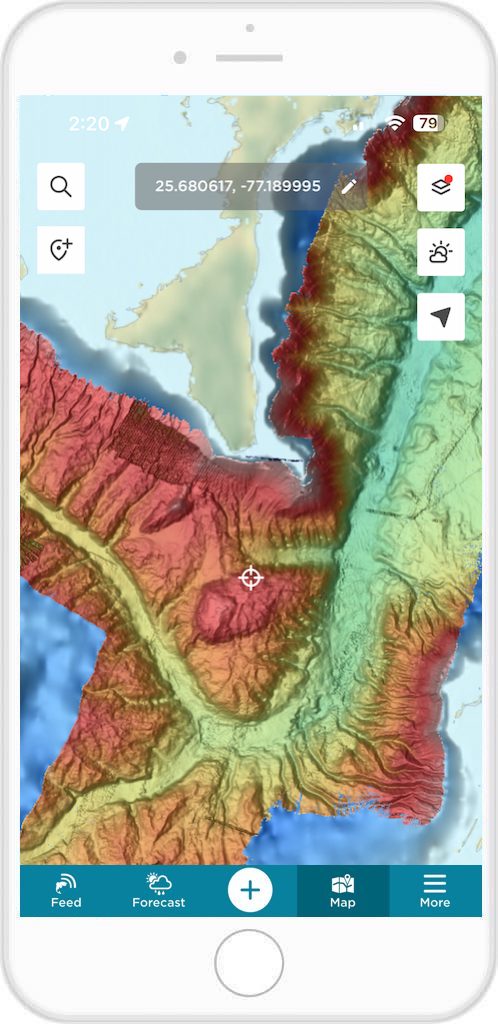
Shaded Relief Map Layer
Shaded relief maps hold a special significance for anglers as they add a whole new dimension to our fishing pursuits. These maps bring the underwater world to life, using visual cues to showcase the contours and features of the seafloor. For us, this means being able to envision the hidden terrain beneath the waves, from deep trenches to submerged structures. Shaded relief maps are invaluable tools for understanding the intricate underwater landscape, helping us identify where fish might be congregating and where the best fishing spots are likely to be found. With this visual aid, we can plan our fishing strategies more effectively, ensuring that we’re in the right place at the right time to maximize our chances of a bountiful catch. In essence, shaded relief maps are like the artist’s brushstrokes on our canvas of exploration, enhancing our angling experience and opening up a world of underwater possibilities.
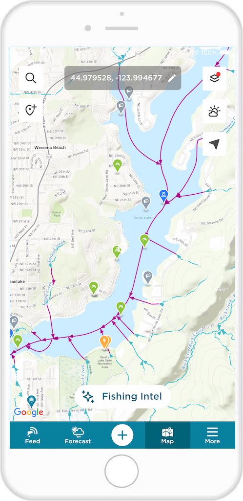
USGS Water Flow Direction Map Layer
USGS Water Flow Direction maps are a crucial resource for anglers seeking to decipher the intricate movements of aquatic environments. Ultimately, these maps act as a compass for the flow of water, illustrating the direction in which rivers and streams meander through the landscape. For anglers, this information is gold, as it unveils the natural highways that fish use to migrate, feed, and spawn. Understanding water flow directions is like having a backstage pass to a fish’s world, allowing us to strategically position ourselves along their routes. With these maps in hand, we can anticipate where fish are likely to gather, optimizing our angling efforts and increasing our chances of a successful day on the water. In essence, USGS Water Flow Direction maps are the navigational charts that guide us to the most promising fishing spots along the dynamic currents of rivers and streams.
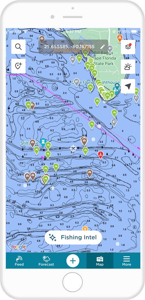
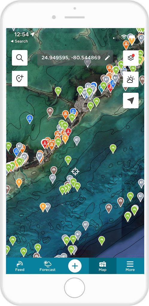
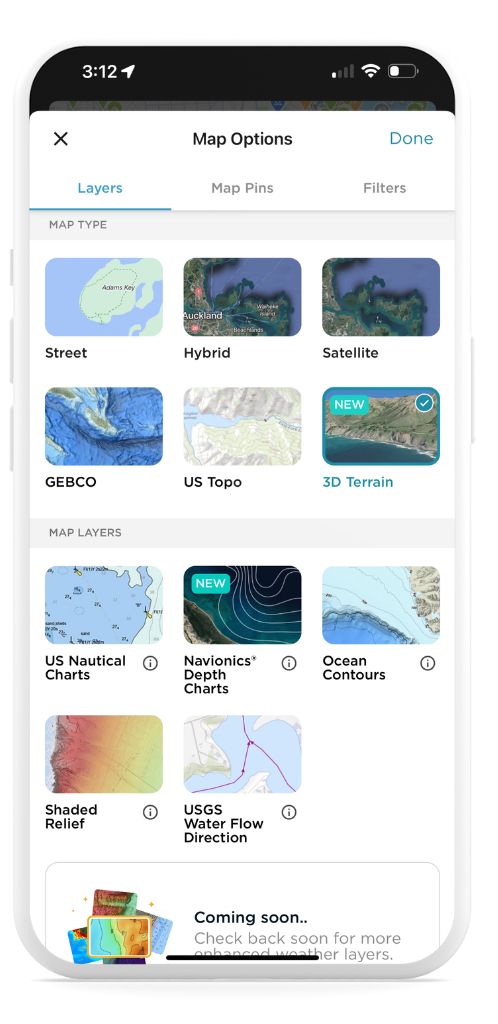
To Access Map Layers on the App:
- Open the FishAngler app on your device
- Tap the “Map” icon at the bottom of your app screen
- Select the layer icon at the top right-hand corner of your map screen
- Choose the map layer you would like to use in the Map Layers section
- Tap “Done” at the top right-hand corner of the screen
- Navigate to the area of the map you’d like to explore with this layer
For anglers, success goes hand in hand with knowledge and preparation, and that’s where precision mapping becomes essential. FishAngler VIP Premium fishing map layers aren’t just tools; they’re the keys to unlocking angling excellence.
These features, available only to FishAngler VIP subscribers, provide crucial insights that make a world of difference. Nautical Charts ensure safe navigation, Ocean Contours reveal prime fishing spots, the Shaded Relief layer adds depth to strategies, and Water Flow Direction maps guide us along the currents. With these mapping layers, anglers can fish smarter, locate hotspots, and adapt to changing conditions.
So, whether you’re chasing trophy fish or savoring the serenity of the water, remember these tools are your companions on the journey to angling greatness. Happy fishing!
Don’t have the FishAngler app? Download it for FREE now: