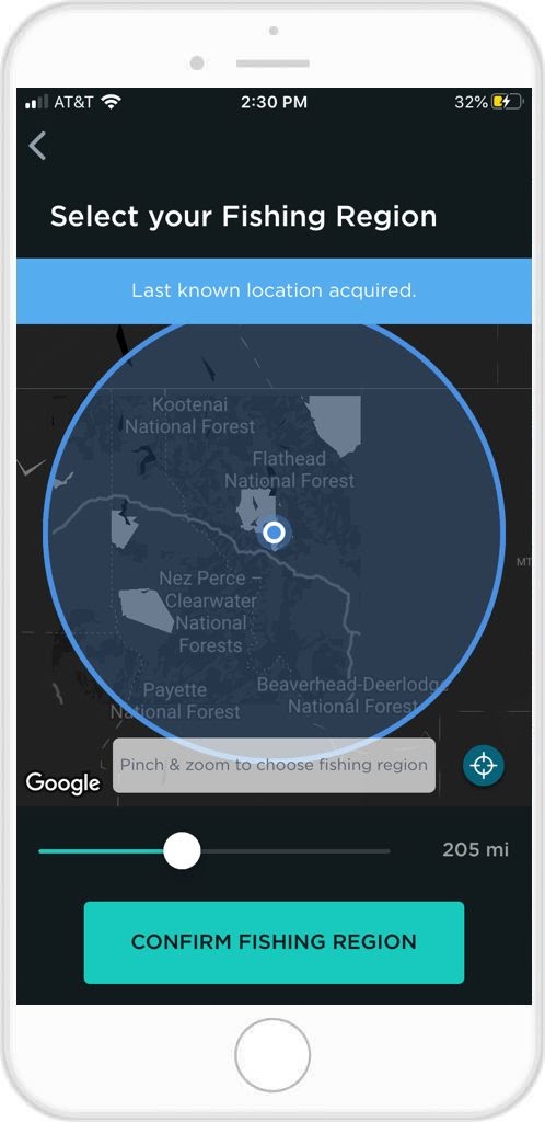
 Select Your Location
After you create and confirm your FishAngler account, you will be asked to select your fishing region.
- Tap select, and if your phone’s GPS location services are on, FishAngler will locate your home location and provide a radius around that area.
- The radius dictates how far away other anglers have to be for you to see their catches and info on your local feed. You can set the radius up to 500 miles away for a variety of catches on your feed, or shrink it down to 10 miles to see only catches from your immediate area.
- you can also manually set your location by dragging the map to a specific area.
The region you select will determine your map data and local catch and water data.
 Navigating Your Map
- Use one finger to scroll to different areas on your map
- Tap the crosshairs in the bottom right corner to center on your location
- Use the + and – icons to zoom in and out. (or swipe two fingers close together, or further apart)
- To toggle between satellite imagery, highways and roads and a hybrid of the two, tap the icon in the top right corner of your map. Then choose between hybrid, standard and satellite.
- Search for other fishing areas using the search bar at the top
Toggle Between Map Layers
You can define what you see on your map, by choosing between several different layers offered. To select these layers…
- Tap the icon in the top right of your screen
- choose from the following map layers:
- Bodies of Water (names of all bodies of water)
- Catches (user submitted catches)
- Fishing Spots (User submitted info on fishing spots)
- Photos (user submitted catch photos only)
- Reports(user submitted fishing reports)
- Buoys (buoy and station locations)
- Gauges (Water level and temperature gauge locations)
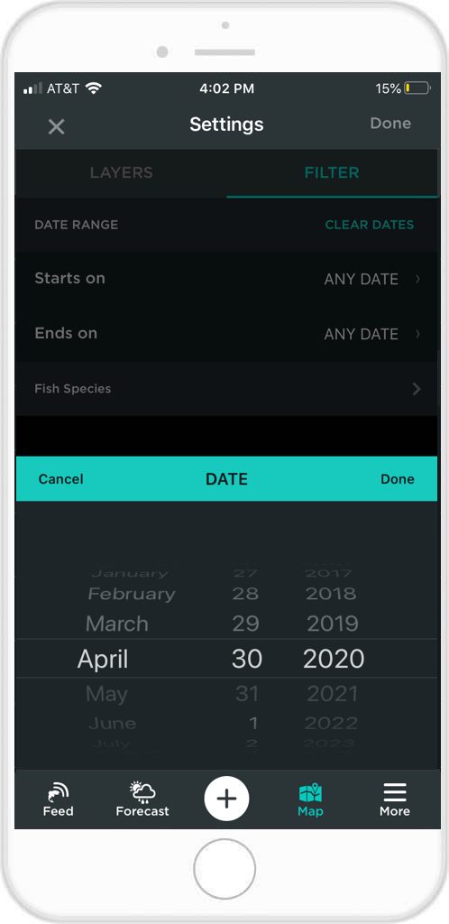 Filter Your Maps
You can filter the information provided on your maps for more precise information.
- Tap the icon in the top right of your map screen
- Tap filter, toward the top of your screen
- Select specific slot dates of catches, reports, photos, or fishing spots (only catches made between your selected dates will appear on your map)
- Select Specific Species (only catches featuring the specific species you selected will appear on your map screen)
Tight lines!
Download the FishAngler app for FREE!