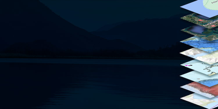
With Navionics, you can explore sonar depth charts that reveal detailed views of the underwater landscape in your favorite fishing spots. These charts offer precise, one-foot HD bottom contour details enhanced by boater-contributed sonar logs, giving you unparalleled insights into the underwater environment.
Whether you’re a seasoned angler or just starting out, understanding the underwater topography can make all the difference in finding the best fishing spots. Dive into our guide to discover how to access and utilize this powerful new feature in your fishing toolkit below!
Don’t have the FishAngler app? Download it for FREE now:
![]()

Unlocking the Power of Sonar Depth Charts
Depth charts are essential for pinpointing drop-offs, shallows, and other prime fish habitats. Recognizing their importance, FishAngler has partnered with Navionics™ to bring you the most accurate depth charts available. Now, FishAngler VIP members can take advantage of Navionics bathymetry maps as an additional layer on the FishAngler Map.
Navionics, a leader in sonar and bathymetric depth maps from Garmin, provides high-definition bottom contour maps that are perfect for identifying the best fishing spots at any water level. These maps, accurate to 0.5 meters, integrate seamlessly with all FishAngler map functions, including waypoints and catch locations.
Transform Your Fishing with Detailed Underwater Features
Understanding underwater features like deep pools and shallows where baitfish gather can transform your fishing experience from just fishing to catching. The FishAngler app, combined with Navionics depth charts, eliminates guesswork by displaying your precise location along with detailed bottom features of any lake or ocean.
This tool enhances real-time navigation on the water and serves as an excellent pre-trip scouting tool. By analyzing the bottom structure of your planned fishing site, you save valuable time otherwise spent on navigation. Instead, use waypoints and depth charts to target the best fishing spots right at the start of your trip.
 Garmin’s Navionics stands out by filling gaps left by other depth charts, thanks to a broad base of contributors adding sonar-based depth maps across numerous water bodies. Navionics is particularly useful for large bodies of water like lakes and oceans.
Navionics depth charts are continually updated with new data from users, ensuring your maps reflect the latest changes in underwater topography.
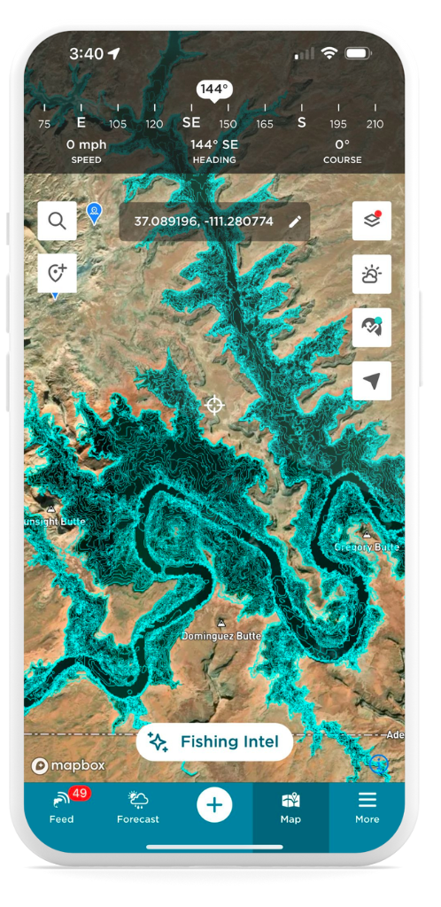
How To Access Navionics HD Charts
FishAngler VIP members in the US, Canada, Australia, New Zealand, and Europe can access depth maps on the app.
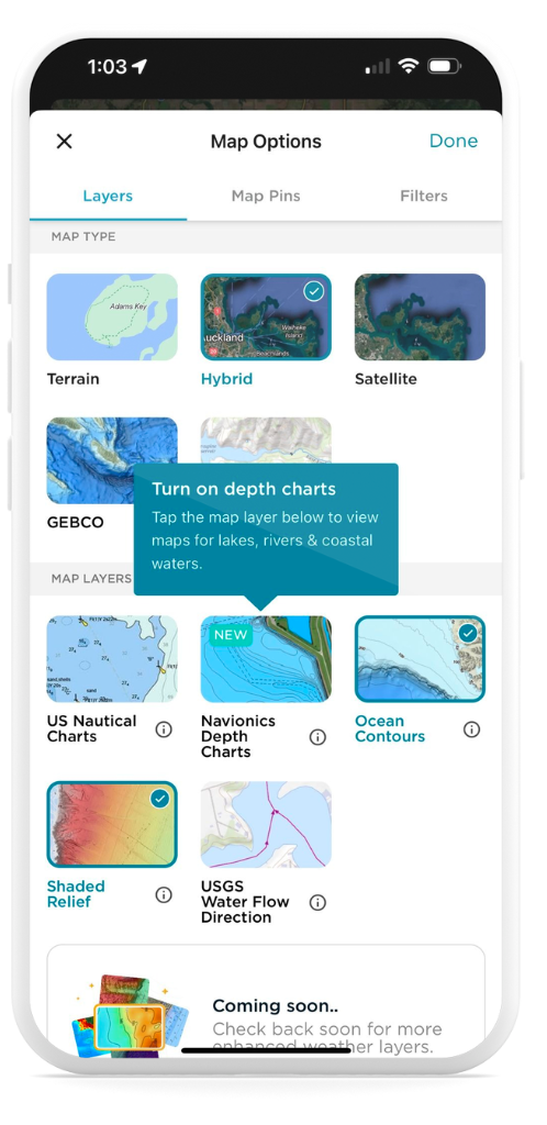 To access depth maps:
- Tap on the Map icon at the bottom of the app screen
- Select the Layer icon in the upper-right corner of the Map screen
- Choose “Navionics Depth Charts” under the Map Layers options
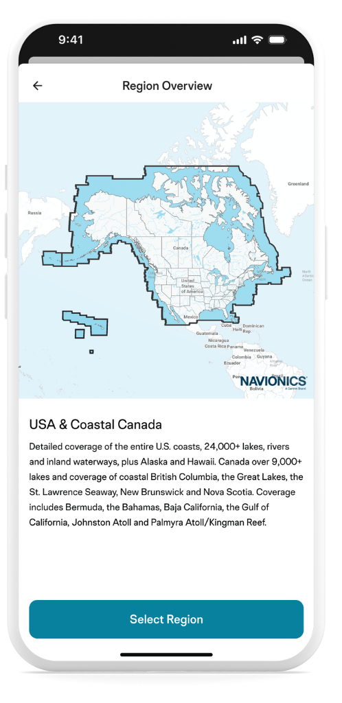
- Review your Navionics region options and select your region
- Noting you can only choose one region over a 30 days, confirm coverage
- Hit the “Done” button in the upper-right corner of the Map Options menu
With the new Navionics maps, FishAngler VIP users can navigate their favorite waters with unprecedented detail. Explore the Depth Contour Charts from Navionics today and elevate your fishing trips.
For more details, visit our FAQ page to find tips on making the most of this exciting new tool!
Don’t have the FishAngler app? Download it for FREE now:
![]()