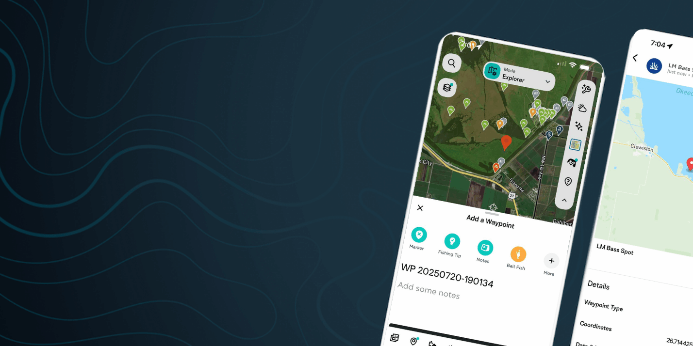
In the ever-evolving world of fishing, technology continues to play a pivotal role in enhancing the angling experience. FishAngler, a leading fishing app, is at the forefront of this technological revolution, offering anglers a suite of advanced map types to elevate their fishing game. In this blog, we’ll explore the various map types available on the FishAngler app: Street, Hybrid, Satellite, GEBCO, USGS Topo, and 3D Terrain Maps.
Don’t have the FishAngler app? Download it for FREE now:
![]()

Street Map
 Hybrid Map
The Hybrid map combines the best of both worlds by overlaying street maps and satellite imagery. This dual-layered approach offers a comprehensive view of the area, making it easier to navigate both on and off the water. Anglers can see roads, trails, and landmarks alongside natural features, ensuring they have all the information needed to find the perfect fishing spot.
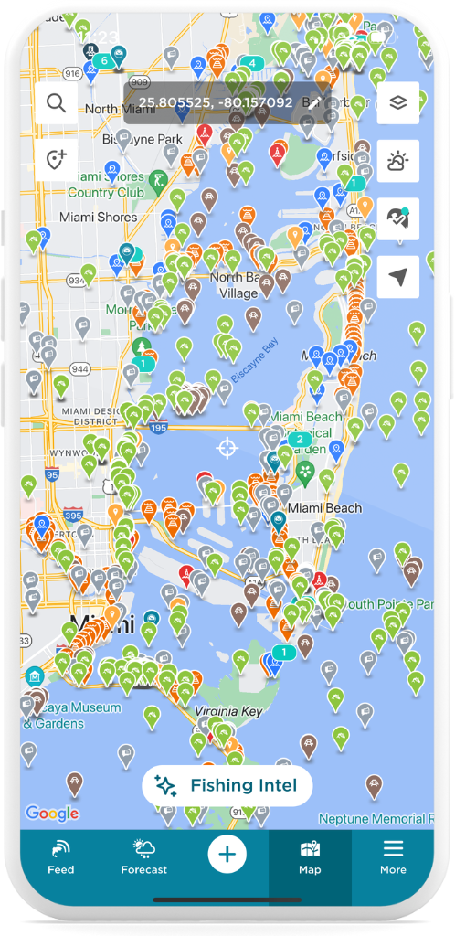
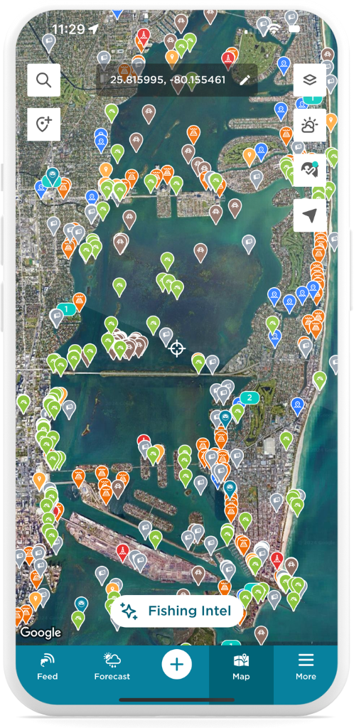
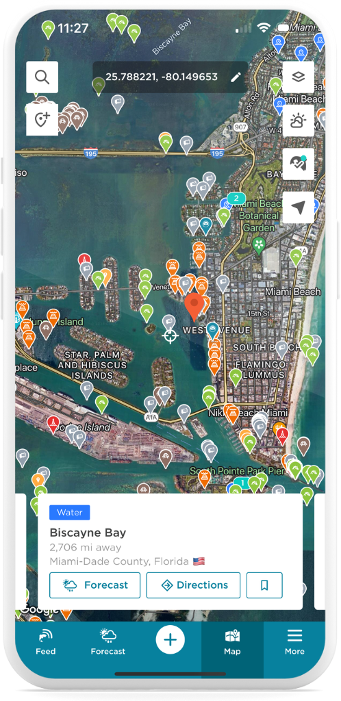 Satellite Map
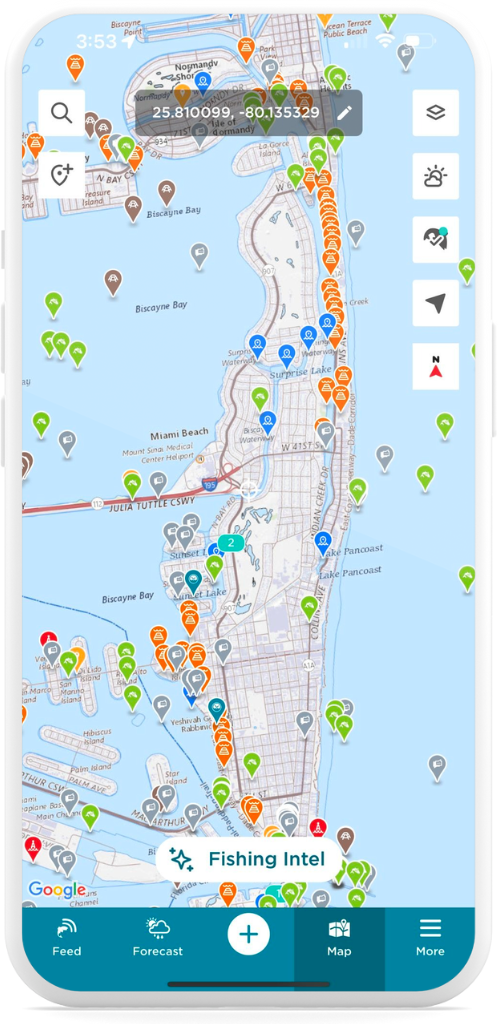
The Satellite map type provides high-resolution images of the earth’s surface, giving anglers a bird’s-eye view of their fishing locations. This map is particularly useful for identifying water bodies, shorelines, and vegetation. With the Satellite map, anglers can spot underwater structures, weed beds, and other critical features that might attract fish.
 GEBCO Map
One of the most advanced map types offered by FishAngler is the General Bathymetric Chart of the Oceans (GEBCO). This map compiles bathymetric data from various sources to deliver detailed images of ocean depths and underwater terrains. Traditionally used by marine researchers and navigators, the GEBCO map type provides anglers with a comprehensive understanding of underwater landscapes, including ridges, canyons, and trenches. This information is crucial for developing effective fishing strategies and pinpointing areas where fish are likely to congregate.

Enhanced Fishing Strategies with GEBCO The GEBCO map type allows anglers to go beyond surface features and explore the underwater environment. Understanding the underwater landscape helps in devising strategies based on the behavior and movement patterns of fish. For example, predatory fish might be found near underwater drop-offs, while certain species may hide in structures. This knowledge enables anglers to refine their approaches and increase their chances of success.
Planning Fishing Expeditions with GEBCO Whether you’re exploring new waters or revisiting familiar ones, the GEBCO map type is an invaluable planning tool. It helps identify potential fishing zones based on the underwater landscape, allowing you to tailor your trips to target specific species or conditions. Additionally, the GEBCO map offers educational insights into aquatic ecosystems and how underwater geography affects fish behavior, promoting more informed and responsible angling practices.
US Topographical Map
The USGS National Map is a powerful resource for anglers, providing detailed topographic information from the U.S. Geological Survey. This map type includes a wide range of data, such as elevation, hydrography, and land cover, making it an excellent tool for understanding the physical characteristics of fishing locations. Anglers can use this map to plan access routes, identify water features, and gain a better understanding of the surrounding environment.
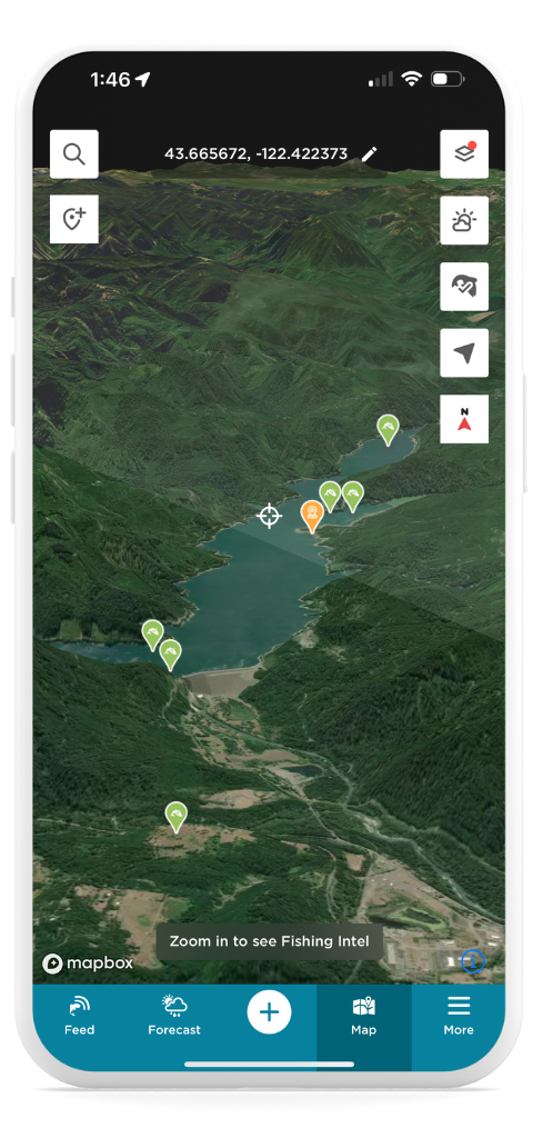
3D Terrain Map
The 3D Terrain Map is a valuable tool for anglers, offering detailed topographic data that brings the landscape to life. With realistic 3D views of elevation, landforms, and water features, this map provides a clear understanding of fishing locations. Anglers can explore the terrain in-depth, plan access routes, and identify water bodies, all while gaining a more immersive view of the surrounding environment to enhance their fishing trips.
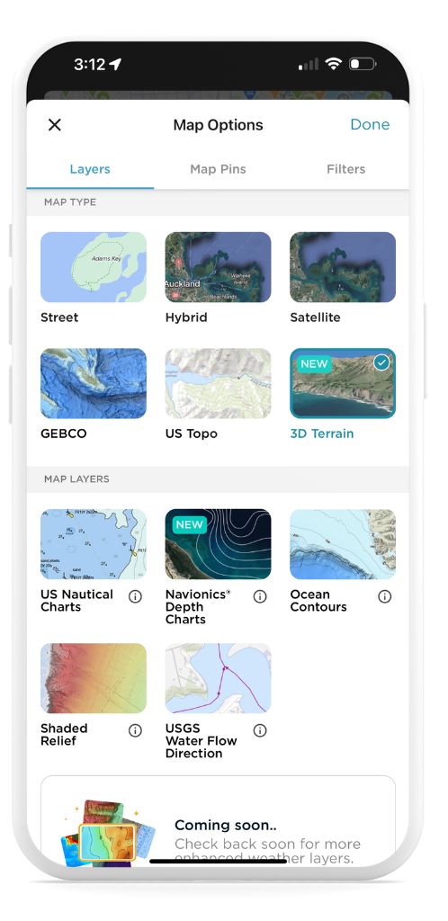
How to Access Map Types on the FishAngler App:
- Open the FishAngler app on your device.
- Tap the “Map” icon at the bottom of your app screen.
- Select the layer icon at the top right-hand corner of your map screen.
- On the Map Options screen, choose your desired map type.
- Tap “Done” at the top right-hand corner of the screen.
- Navigate to the area of the map you’d like to explore.
 The FishAngler app’s diverse map types—Street, Hybrid, Satellite, GEBCO, US Topo, and 3D Terrain Maps—provide anglers with an array of tools to enhance their fishing experience. From detailed topography and high-resolution imagery to comprehensive underwater data, these maps offer valuable insights that can help anglers plan their trips, refine their strategies, and deepen their understanding of aquatic environments.
Whether you’re a seasoned pro or just starting out, these map types are indispensable tools in your fishing arsenal.
Don’t have the FishAngler app? Download it for FREE now:
![]()