2024 was our most exciting year yet, thanks to the incredible contributions of FishAnglers worldwide! Your shared catches, expert tips, and favorite fishing memories brought our global angling community closer than ever. Meanwhile, our development team worked tirelessly to introduce game-changing features, enhancing your fishing experience like never before. We’re thrilled to highlight some of the most significant milestones, including exciting new functionalities and key statistics that defined 2024. Let’s dive into the details!
New Features
Real-Time Water Gauges
With real-time data from over 12,000 United States Geological Survey (USGS) monitoring stations, you can now access crucial information on river flow, gauge height, and water temperature, all in one place.
Understanding river conditions before you head out can make a huge difference in your fishing success. With FishAngler’s river gauge feature, you can view detailed, up-to-date readings to help you plan your trips more effectively, no matter the conditions.
 How to Access Water Gauges
Getting started with water gauges on FishAngler is simple:
- Open the Map: Tap the Map icon at the bottom of the app.
- Find Gauges: Look for the river gauge icons on the map.
- Select a Gauge: Select a gauge pin to see all the data.
- Tap the Gauge Card: See flow, gauge height, and temperature for that gauge by day, week, month or year.
- Explore the Data: Drag along the trendline to see how conditions have changed over time. Compare current readings with historical averages to better understand river patterns.
GPX Import/Export
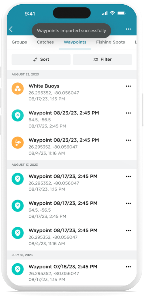
Fishing enthusiasts are always on the lookout for tools and technologies that can amplify their fishing experience. One such innovation that has been gaining traction is the ability to import and export coordinates from fish finder devices.
With FishAngler, VIP subscribers now have the power to seamlessly integrate their fishing device data, regardless of the brand they use, into their fishing strategies. Let’s explore how this feature is changing the way anglers navigate and locate their prized catches.
FishAngler prides itself on its compatibility with all major fish finder brands. Whether you’re using devices from Garmin, Lowrance, Humminbird, or any other renowned brand, FishAngler ensures seamless integration. This eliminates the hassle of switching between different apps or platforms, streamlining the process for anglers. For more information on how to import and export your GPX coordinates from your fishing device, see Sync Your Fish Finder With FishAngler.
Map Layers
Navionics™ Depth Charts
With Navionics, you can explore sonar depth charts that reveal detailed views of the underwater landscape in your favorite fishing spots. These charts offer precise, one-foot HD bottom contour details enhanced by boater-contributed sonar logs, giving you unparalleled insights into the underwater environment.
Depth charts are essential for pinpointing drop-offs, shallows, and other prime fish habitats. Recognizing their importance, FishAngler has partnered with Navionics™ to bring you the most accurate depth charts available. Now, FishAngler VIP members in US, Canada, Australia, New Zealand, and Europe can take advantage of Navionics bathymetry maps as an additional layer on the FishAngler Map.
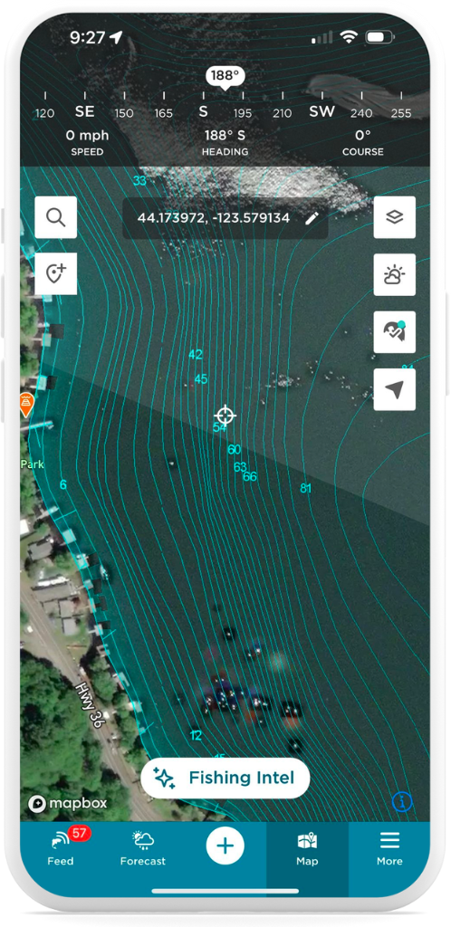
To access depth maps:
- Tap on the Map icon at the bottom of the app screen
- Select the Layer icon in the upper-right corner of the Map screen
- Choose “Navionics Depth Charts” under the Map Layers options
- Review your Navionics region options and select your region
- Noting you can only choose one region over a 30 days, confirm coverage
- Hit the “Done” button in the upper-right corner of the Map Options menu
Public Lands Maps
Public land fishing access is an ever-evolving landscape across the U.S. But with the launch of FishAngler’s new Public Lands Layer, finding your next fishing spot has never been easier. Whether you’re casting a line in a local city park or planning a trip to a national forest, FishAngler has mapped millions of acres of potential fishing territory. Let’s explore some of the most common types of public lands available for fishing and how to use this new feature to access prime water near you:
- State Parks: Widely available and often rich with fishing opportunities, state parks can be found nationwide. They frequently feature lakes, rivers, and coastal access points, though some may require entrance fees or have specific regulations.
- National Forests: Primarily located in the western U.S. but also available in states like Virginia and North Carolina, national forests offer thousands of miles of fishable streams and lakes. Generally free to access, these areas are ideal for anglers seeking less crowded spots.
- National Parks: Renowned for their scenic beauty, national parks like Yellowstone and Everglades also provide excellent fishing. Be sure to check specific park rules, as many have special fishing licenses or restrictions.
- Bureau of Land Management (BLM): Covering vast areas in the West, BLM lands are great for extended fishing trips, offering free access to rivers like the Snake and Missouri.
- City Parks: Closer to urban areas, city parks often provide convenient access to fishing spots without entrance fees. They’re perfect for quick trips or a casual day on the water.
- Fishing Access Sites: Designated specifically for anglers, these sites allow you to launch boats or fish directly from shore. They’re typically free and easy to find through the FishAngler map.
How to Access Public Lands on FishAngler
Getting started with the Public Lands layer is easy:
- Open the Map on the FishAngler app.
- Tap the Map Options icon in the upper-right corner.
- Select Public Lands from the available layers.
- Confirm Your Selection: Tap “Done” in the upper-right corner to activate the Public Lands layer.
- Tap on the shaded areas to explore the type of land and any relevant information, including acreage and access details.
Map Types
3D Terrain Maps
With 3D terrain maps, you can explore intricate above-water landscapes, transforming your fishing strategy and enhancing your experience. Get ready to see your fishing locations like never before and make every trip more productive and enjoyable.
Our 3D terrain maps go beyond traditional flat maps, offering a dynamic perspective of above-water landscapes. This detailed view helps you understand the terrain and navigate with enhanced accuracy, making it easier to pinpoint ideal fishing spots and optimize your strategy.
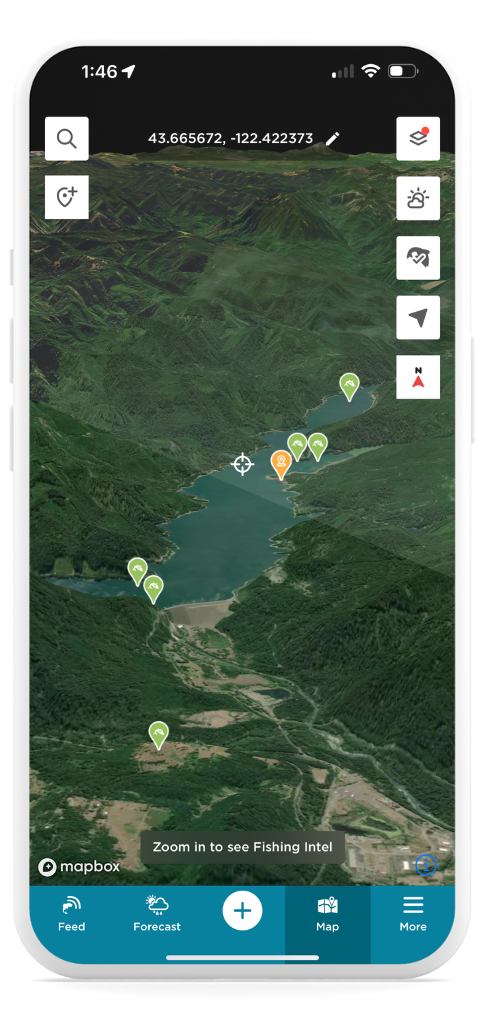 How to Access 3D Terrain Maps
Getting started with 3D terrain maps is easy:
- Open the Map: Tap the Map icon at the bottom of the app.
- Access Map Layers: Tap the Map Options icon in the upper-right corner.
- Select 3D Terrain: Choose “3D Terrain” from the available options.
- Confirm Your Selection: Tap “Done” in the upper-right corner to activate the 3D terrain layer.
- Customize Your View: Use the controls to adjust the map’s tilt and rotation for the best perspective.
Milestones and Highlights
🎣 5 Million Anglers Strong
- The FishAngler community grew to an incredible 5 million users in 2024, connecting anglers from around the globe in their shared passion for fishing.
🎣 500K Catches Logged
- An astounding half a million catches were logged this year, showcasing the dedication and skill of our angling community.
🎣 Most-Caught Species
- Largemouth bass continues to dominate freshwater with over 53,000 recorded catches, while red drum holds the title as the top saltwater species, with over 2,100 catches.
🎣 240+ Countries and Territories
- Fishing enthusiasts from across the world showcased their skills, contributing to our platform’s rich tapestry of global angling expertise.
🎣 Highest-Rated Fishing App
- With a stellar 4.8-star rating in app stores, FishAngler remains the #1 fishing app, thanks to your support and engagement!
Thank You!
To our amazing community: thank you for making 2024 unforgettable! With your enthusiasm and support, we’re excited to keep improving FishAngler and bring you even more incredible features and updates in the coming year. Here’s to a 2025 filled with tight lines, memorable adventures, and plenty of new milestones. Stay tuned for what’s next as we continue elevating the FishAngler experience together!
Tight Lines!
– FishAngler Team
Download the FishAngler app for FREE!
