2023 was our best year yet thanks to FishAnglers around the world. Last year, you generously shared your catches, expertise, and favorite fishing memories with our global fishing community. And that’s not all! Our development worked hard to release a record amount of exciting new features like state and world fishing record access, premium fishing map layers, private waypoints, and more! We also welcomed more users than ever before to the platform and maintained our status as the highest-rated fishing app in the app stores.
Here are some key highlights from the year including milestones like top-caught species and anglers that dominated the app. Let’s dive in!
New Features
IGFA
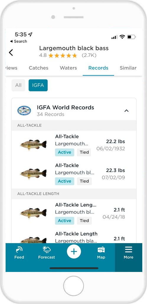
To access Fishing Records on the app:
- Open the FishAngler app on your device
- Tap the “More” menu at the bottom of your app screen
- Scroll down to the Records section and tap “IGFA
- To search by species: type in the species you’d like to access records on in the Search field at the top of the screen
- To search by category: toggle to the Species, Category, Country or Waters you’d like to search for records on
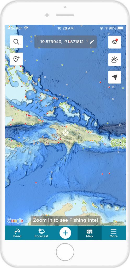
Map Layers
The key to a successful day on the water lies in understanding the underwater terrain, the movements of aquatic life, and the hidden hotspots where fish are most likely to bite. That’s why we’re so excited to introduce game-changing fishing map layers – exclusive to FishAngler VIP subscribers.
Nautical Charts Map Layer
- Nautical chart maps serve as indispensable guides for anglers, acting as navigational GPS, revealing the secrets of the sea, and providing essential information to ensure safe and precise fishing locations in the vast and unpredictable oceanic realm.
Ocean Contours Map Layer
- Ocean contour maps are essential tools for anglers, offering a comprehensive understanding of underwater terrain to identify prime fish habitats, study migration patterns, and locate hotspots. They also provide crucial information on water depths, enhancing safety, and optimizing route planning for a successful and enjoyable fishing experience on open waters.
Shaded Relief Map Layer
- Shaded relief maps bring the underwater world to life for anglers, offering a visual understanding of seafloor contours and structures. These invaluable tools help us identify prime fishing spots, plan strategies effectively, and enhance our angling experience by unlocking a world of underwater possibilities.
USGS Water Flow Direction Map Layer
- USGS Water Flow Direction maps serve as vital tools for anglers, acting as a compass for understanding the intricate movements of aquatic environments by revealing the natural pathways that fish use for migration, feeding, and spawning. These maps provide valuable insights, enabling strategic positioning along water routes and optimizing angling efforts, essentially serving as navigational charts to guide anglers to promising fishing spots along dynamic river and stream currents.
More to Come!
- VIP premium fishing map layers are essential for empowering anglers to fish more intelligently, find hotspots, and adapt to changing conditions for success. That’s why the FishAngler development team is diligently working to introduce additional map layers to the app. Stay tuned for the upcoming release of Sea Surface Temperature, Chlorophyll Concentration, Sea Currents, Sea Surface Height Anomaly, Sea Surface Wind, and True Color map layers!
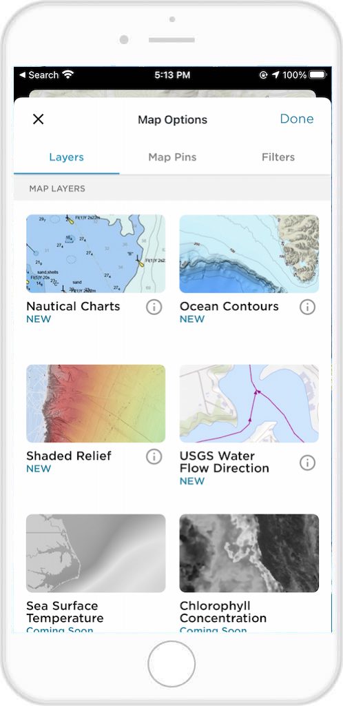
To Access Map Layers on the App:
- Ensure that you have an active FishAngler VIP subscription
- Then, open the FishAngler app on your device
- Tap the “Map” icon at the bottom of your app screen
- Select the layer icon at the top right-hand corner of your map screen
- Choose the map layer you would like to use in the Map Layers section
- Tap “Done” at the top right-hand corner of the screen
- Navigate to the area of the map you’d like to explore with this layer
Map Types
In angling, technology is transforming the fishing experience, and the FishAngler app takes it further by introducing the General Bathymetric Chart of the Oceans (GEBCO) and United States Geological Survey (USGS) National Map types. The GEBCO map is a global initiative that compiles bathymetric data to offer anglers a comprehensive understanding of underwater landscapes, revolutionizing the exploration of water bodies. The USGS National Map provides detailed topographic information beneficial for anglers, offering insights into the geographic features of a region to aid in fishing planning and navigation.
To access Map Types on the app:
- Open the FishAngler app on your device
- Tap the “Map” icon at the bottom of your app screen
- Select the layer icon at the top right-hand corner of your map screen
- On the Map Options screen, tap the GEBCO or USGS National Map type
- Tap “Done” at the top right-hand corner of the screen
- Navigate to the area of the map you’d like to explore with this view
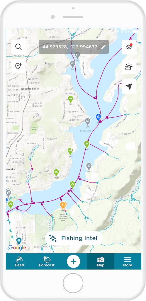
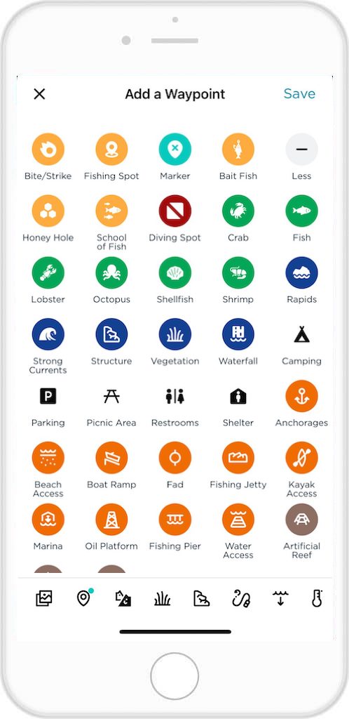
Private Waypoints
In the world of angling, each cast, every tug, and every chosen spot narrates a distinct story. What if you could weave a trail of your fishing adventures, a digital journal of angling escapades guiding you back to those exhilarating moments whenever you wish to revisit them? Exclusive to FishAngler VIP subscribers, Private Waypoints are more than mere map coordinates; they are your personal pins, marking the locations where your cherished fishing memories come to life.
To access Private Waypoints on the app:
- Ensure that you have an active FishAngler VIP subscription
- Then, open the FishAngler app on your device
- Tap the “Map” icon at the bottom of your app screen
- Select the waypoint icon at the top left-hand corner of your map screen
- Tap the “Add a Waypoint” option at the top of the waypoint menu
- Adjust the position of the marker on the map, edit the marker and add details
- Hit “Save” in the upper-right corner of the Add a Waypoint screen
Milestones
🎣 4 Million Anglers Worldwide
🎣 240 Countries and Territories
🎣 Highest-Rated Fishing App
- We are grateful to our dedicated community for their ongoing support, as FishAngler proudly maintains its status as the top rated fishing app in the app stores with an outstanding 4.8-star rating. Thank you for helping us achieve and sustain this milestone!
🎣 Most-Caught Species
- In our angling community, the largemouth bass remains the most-caught freshwater species, with an impressive 52,407 catches, while the red drum takes the lead among saltwater species with a notable 2,039 catches.
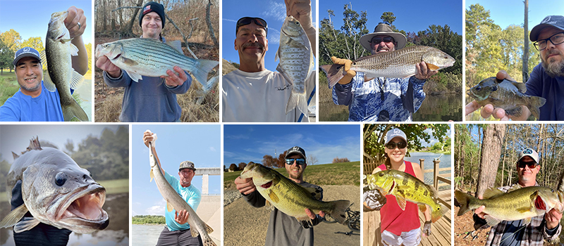
Top Anglers
- Featuring an impressive surge in recorded catches, captivating photos, outstanding platform engagement, and garnering accolades across yearly leaderboards, we’re excited to showcase some standout anglers in 2023. Congrats @tonerock, @perez_rick, @mollo_nick, @rwbarnes43, @williams_brad, @ariesm, @hunterdubs.fwtx, @paul_wall318, @ghornsby316, and @bnakai for slaying in 2023! 🙌 As we eagerly anticipate anglers’ Bucket Lists for 2024, we extend our best wishes to all for tight lines and abundant success in the coming year!
Thank You!
A huge thank you to every member of our fishing community! As we wrap up an incredible year at FishAngler, we’re setting our sights to an incredible new year of fishing adventures. Get ready for a wave of new features, exciting updates, and unforgettable catches in 2024! Stay hooked as we elevate FishAngler to new heights! 🌊
Wishing you all an extraordinary 2024 filled with unforgettable memories on the water.
Tight Lines!
– FishAngler Team
Download the FishAngler app for FREE!