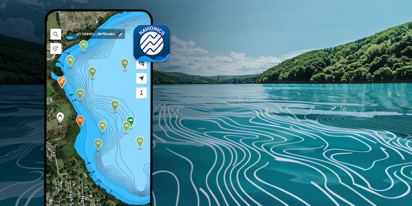
No fish finder? No problem! At FishAngler, we know that finding the perfect fishing spot can make all the difference in your catch. That’s why we’re thrilled to introduce our depth contour maps, designed to set you up for success whether you’re fishing from the shore or from a boat.
With FishAngler, you can now access precision depth maps from Garmin Navionics™, bringing you detailed underwater topography right at your fingertips. These maps make it easier than ever to identify the best fishing locations, ensuring you spend less time searching and more time reeling in those big catches.
Join us as we dive into how FishAngler’s depth contour maps can transform your fishing experience and help you become the angler you’ve always aspired to be.
Don’t have the FishAngler app? Download it for FREE now:
![]()

Getting Started with Depth Maps
To start using depth maps in FishAngler, make sure you have a FishAngler VIP membership and a stable internet connection.
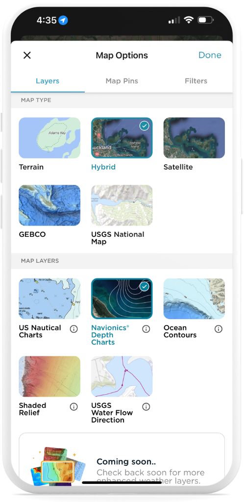
Follow these steps to enable the depth contours layer:
- Tap on the Map icon at the bottom of the app screen
- Select the Layer icon in the upper-right corner of the Map screen
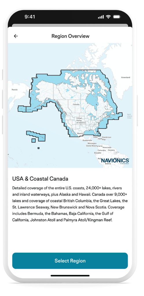
- Choose “Navionics Depth Charts” under the Map Layers options
- Review your Navionics region options and select your region
- Noting you can only choose one region over a 30 days, confirm coverage
- Hit the “Done” button in the upper-right corner of the Map Options menu
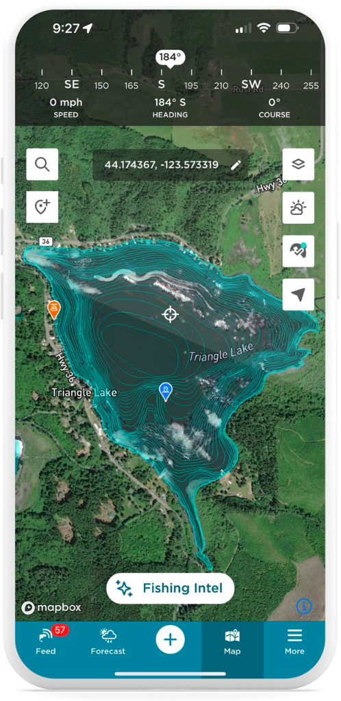
Understanding Depth Contour Maps
Depth contour maps are essential tools for identifying underwater features that are prime fish habitats. These maps, often referred to as bathymetric maps, provide detailed representations of the underwater terrain, showcasing the variations in depth and the topography of the lake or ocean floor. By interpreting these contour lines, anglers can locate structures such as drop-offs, ledges, humps, and channels, which are known to attract various fish species.
Understanding these features helps in predicting fish behavior, selecting the right fishing spots, and ultimately increasing the chances of a successful catch. Whether you’re a seasoned angler or a beginner, mastering the use of depth contour maps can significantly enhance your fishing experience.
 Here’s how to read and interpret them effectively:
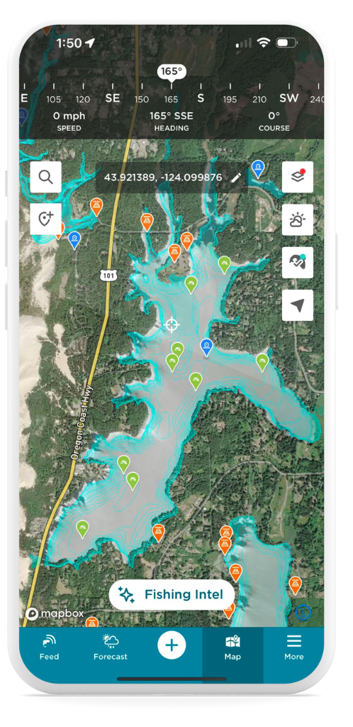
Contour Lines
- Contour lines on a depth map are like the topography lines on a land map, but they show the underwater landscape instead. These lines represent the underwater terrain, giving you a clear picture of the seabed’s structure. When the contour lines are close together, it indicates steep slopes or sudden drop-offs, which can be crucial areas for certain types of fish. Conversely, lines that are spaced further apart indicate gentle slopes or flat areas. Understanding these lines helps you predict where fish might be hiding or moving, making your fishing trips more productive.
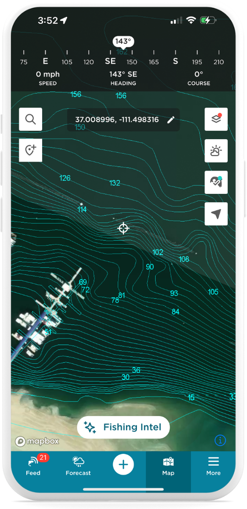
Depth Markings
- Depth markings are numerical indicators placed along the contour lines on the map. These numbers tell you the depth of the water at specific points. By using these markings, you can gauge the underwater landscape’s depth variations, helping you identify deeper holes or shallower flats. This information is essential for choosing the right bait and technique, as different fish species prefer different depths. Accurately reading these markings allows you to target your fishing efforts more effectively.
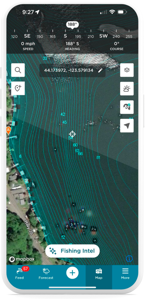
Drop-offs and Ledges
- Drop-offs and ledges are areas where the underwater terrain changes abruptly, often marked by tightly packed contour lines showing a sudden change in depth. These structures are significant because they create natural habitats and feeding grounds for fish. Predatory fish often patrol the edges of drop-offs, waiting for baitfish to swim by. By identifying these features on your depth map, you can position yourself in prime fishing spots where fish are likely to congregate, increasing your chances of a successful catch.
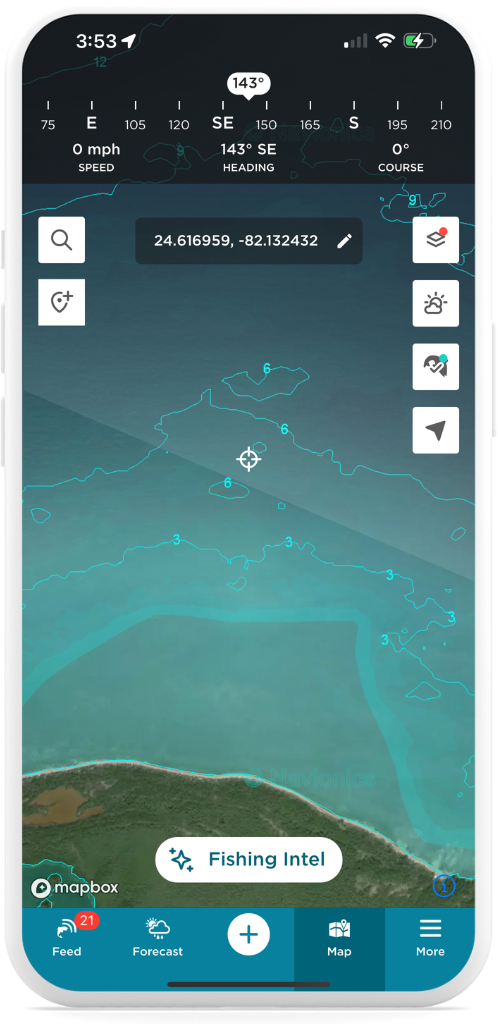
 Shallows and Flats
- Shallows and flats are areas with widely spaced contour lines and lower depth numbers, indicating that the water is relatively shallow. These zones are crucial for spotting baitfish, which in turn attract larger predatory fish. Shallow areas often warm up faster, creating ideal conditions for fish to feed and spawn. Understanding the location of these shallows and flats helps you plan your fishing strategy, allowing you to target these high-activity zones effectively. By focusing on these areas, you can increase your chances of encountering active, feeding fish.
Using Depth Maps for Trip Planning
Planning your fishing trip using depth maps can save you time and increase your chances of success. Here’s how:
- Pre-trip Scouting: Before heading out, study the map of your chosen fishing location. Identify potential fishing spots like drop-offs, ledges, and shallow feeding areas.
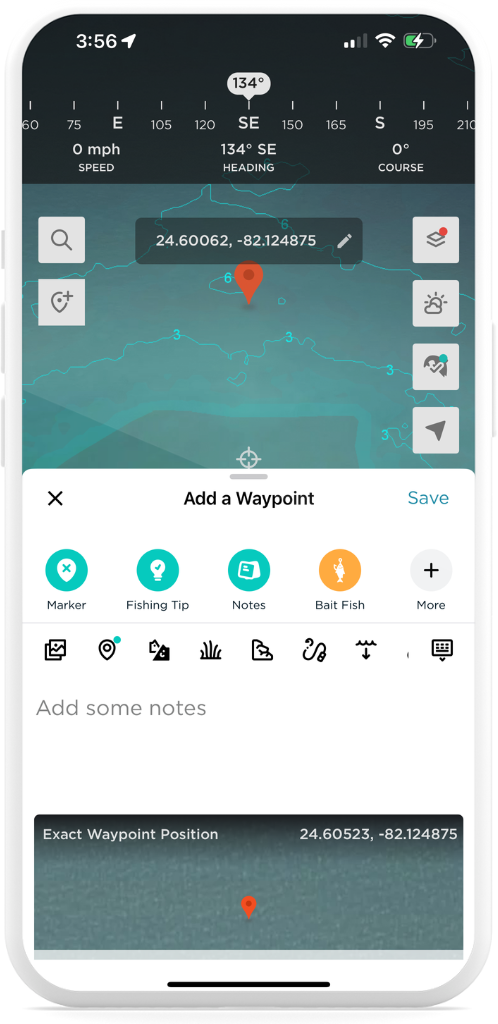
- Waypoint Marking: Use the waypoint feature in FishAngler to mark promising spots on the map. This helps you navigate directly to the best locations when you’re on the water.
- Real-time Navigation: While fishing, use the depth map to track your position relative to underwater structures. Adjust your fishing strategy based on the terrain and fish behavior.
Important Considerations
While FishAngler provides some of the best depth charts available, coverage may vary, particularly in smaller ponds or less popular fishing areas. Always cross-reference with local knowledge and other resources when planning your trip.
 Depth contour maps are powerful tools that can transform your fishing experience, making it easier to locate fish and understand the underwater landscape. With FishAngler’s integration of Navionics HD depth charts, you have access to some of the best underwater contour data available.
Elevate your fishing trips by exploring and utilizing depth contour maps in FishAngler today.
For more details, visit our FAQ page to find tips on making the most of this exciting new tool!
Don’t have the FishAngler app? Download it for FREE now:
![]()